Volcanic risk: results of Asi-Srv project presented today
Space technologies to support volcanic risk management

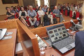
The final workshop of the Italian Space Agency SRV – Volcanic Risk System pilot project was held today, 31 May, in the operating premises of the Civil Protection Department. The objectives of the meeting are the presentation of achieved results and favoring ideas exchange on the potential space technologies for operating use to support volcanic risk management.
The project group headed by the National Institute of Geophysics and Volcanology and made up of a team of research institutes and industries, the Italian Space Agency that funded the research, the Civil Protection Department - that is the final recipient of the project - and few representatives of the scientific community and the Competence Centres regarding volcanic risk were among the participants.
Created in 2007 for new products supporting volcanic risk management, the project has achived important results over the last few years in the fields of surveillance activites, early warning, emergency and post-emergency management. In particular, a complex pre-operating system was created: based on the integration of products generated by data of space missions - especially the ones of the COSMO-SkyMed constellation - was created wit the help of data obtained by monitoring networks of Italian volcanoes. The system - presented to the final recipients with a WebGis interface - was tested on three volcanic test-sites : Etna, Vesuvius and Phlegraean Fields.
For each volcanic risk, maps and other products were created ijn order to identify geophysical parameters that characterize volcanic events, guarantee support during the volcanic eruption management - thanks to high resolution data - and supply, in case of eruption, useful elements for the evaluation of changes in the surface and the distribution of erupted materials. Collected data allowed also the project group to create historical series to implement the knowledge of volcanic systems, like the one that depicts Etna's surface deformations of the last 20 years.