Post-earthquake assessment activities: online the national dataset of structural units
The cartographic project has been realized by the Department, in collaboration with Regions, Autonomous Provinces and Agenzia delle Entrate (Italian Revenue Agency)
Assessing the damage and the agibility of public, private and cultural buildings is one of the first activities carried out by the National Service of Civil Protection after an earthquake. The first priority in an emergency, in fact, is to safeguard the lives of people, ensuring where possible their timely return to homes. Otherwise, when buildings are not considered safe, they must be evacuated and urgently secured to avoid further damage. Up to now, these activities, carried out by teams of Fire Fighters and technicians of the National Service, clashed with the unavailability of the necessary cartography to orientate the inspections and with the heterogeneity of the available data on the origin of the buildings.
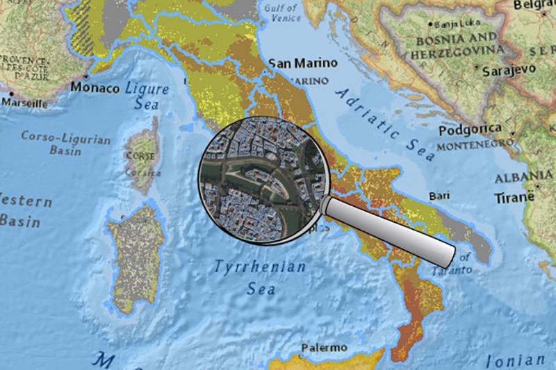
To facilitate these activities, also in implementation of the operational indications for the connection and coordination of the activities of technical inspection post earthquake issued last February 12, the Civil Protection Department has created, in collaboration with the Regions, Autonomous Provinces and the Agenzia delle Entrate, the national dataset of structural aggregates. This database is a collection of highly detailed data on the buildings of our country created, for the most part, from the information contained in the geotopographic databases of the Italian Regions and Autonomous Provinces. In case the data were not available in an exhaustive and updated form, the collection has been integrated with the cartography of cadastral buildings. In addition, the structural aggregates were broken down on the basis of the boundaries of the ISTAT administrative territorial units, updated to 2021. The final product of this project has therefore ensured a consistent standardization of all structural aggregates information at the national level.
The dataset is released with an Open CC-BY 4.0 license for the free use of everyone interested - technicians and civil protection workers, scholars and people interested in civil protection - and it can be integrated with similar cartographies already available at local level.
The purposes of the dataset are many: during the management of an emergency, it could provide a common cartographic basis, on which to converge all the information relating to damage to the building heritage; but it could also be a support for the management of the entire reconstruction process. The national cartography of structural aggregates will also serve in ordinary, to support components and operational structures of the National Service for the planning activities of civil protection, starting from the municipal level. For these purposes, on this cartographic base, the recognition of single buildings/structural units can also be carried out, which will represent a second level deepening.
The cartographic data, divided by macro-regions, and the related metadata are already available for free use, via the GitHub platform, together with general information on the entire project. The data have been made available in shapefile format and require specific software (GIS) to be consulted. These are the links from which to access: