news16 settembre 2022
Marche bad weather, the Copernicus program has been activated
The system will allow mapping of flooded areas
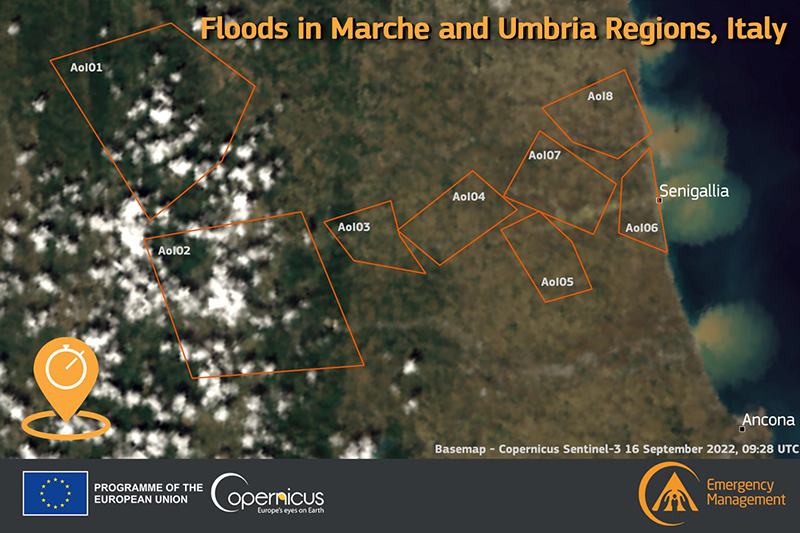
The Civil Protection Department, as the national Authorised User, has activated the European Copernicus Emergency satellite mapping program today to request a mapping of the areas affected by the wave of bad weather in the Marche region. The system will provide maps on the extension of the flooded areas and damage estimation.
As part of the support activities planned during this emergency phase, the department also requested the ASI-Italian Space Agency to reprogram the COSMO Skymed satellite system so as to acquire additional images over the areas affected by the event.