Bad weather in Emilia-Romagna: satellite technologies to monitor the territory
Satellite data and images are a fundamental tool to support emergency activities
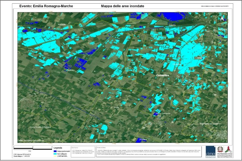
Within the framework of the Emilia-Romagna bad weather emergency, the monitoring activity of the affected territories also involves the acquisition and study of satellite images.
Since 16 May 2023, upon request of the Civil Protection Department, the COSMO-SkyMed satellite constellation of the Italian Space Agency has started to collect data and images of the affected territories according to an acquisition plan defined on a daily basis as the situation changes.
Simultaneously, CIMA Foundation, the competence centre of the Department, has started the processing necessary to identify the flooded areas. These maps provide high-resolution information (5 m) on a large area of the affected region.
With the aim of acquiring very detailed maps of areas of specific interest, with resolutions down to 0.5 m, the Civil Protection Department has activated the JRC, the European Commission's research centre.
The possibility of acquiring images both during the day and at night and at different resolutions is particularly important because it makes it possible to gather useful and complementary information for different flooded areas: urban, rural and areas covered by vegetation.
Planning is also currently underway with the JRC for the use of drones and specific sensors for landslide monitoring.
All the activities in the areas affected by the emergency are conducted in close collaboration with the Emilia-Romagna Region.